
How a Topographic Survey Helps Engineers Design Around Existing Features
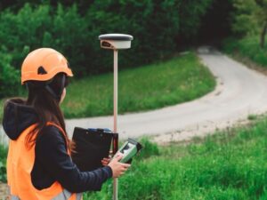
Land is never as flat or as simple as a plat makes it look. Before an engineer designs a single road or building pad, they need to know how the ground really sits. A topographic survey gives them that picture. It maps the height of the land, the way it slopes and the features already on it. For a developer in Fairfax County, Virginia, that data turns a rough idea into a plan the county will accept. The topography controls your lot yield, your grading budget and whether the plan clears review. Get the survey right, and the design has a firm base. Skip it, and the site fights your plan the whole way.
What a Topographic Survey Reveals About the Development Site
A topographic survey records the shape of the land. It captures elevation changes, ground contours and the surface features an engineer has to design around.
A contour is a line that connects points of equal height. Read together, contours show the high spots, the low spots and how steep the ground gets. In Fairfax County, site and grading plans show contours at a maximum two-foot interval. Where the ground is nearly flat, with a slope under two percent, the plan needs tighter one-foot contours or spot elevations. That detail tells the engineer where water sits and where the land drops away.
Surveyors collect this data in the field with GPS and survey instruments. On larger sites they may add drone or aerial methods. The result is one shared base map. Your engineer, architect and grading designer all work from the same measured ground. An engineer working without it is guessing, and guesses get expensive once a crew is on site.
Designing Around Slopes and Changes in Elevation
Elevation data shows engineers where slopes sit and how steep they are. That single fact controls where buildings, roads and grading can go.
A steep slope limits where you can place a pad or run a street. It shapes driveway grades, accessible routes and how much earth you have to move. Engineers call that cut and fill. Cut means shaving dirt off the high spots. Fill means packing it into the low ones. More cut and fill means more cost and more time, so the survey helps the engineer find the flatter, cheaper ground first.
Slope also drives safety and code. A driveway that’s too steep fails review. Accessible routes have strict grade limits, so the survey helps the engineer find paths that meet them without heavy regrading. Fairfax County checks proposed grades against its standards, so a design that ignores the real slopes comes back with comments. Knowing the slopes upfront lets you place lots where they fit instead of forcing them where they don’t.
Using Topographic Survey Data to Plan Drainage
The shape of the land decides where water goes. Engineers read topographic survey data to see how surface water flows and to design drainage that keeps it under control.
Water runs downhill and follows the contours. The survey shows the low points where it pools and the paths it takes as it leaves the site. Engineers use that to size pipes, swales and stormwater controls. A swale is a shallow channel that carries runoff away from buildings and roads. The survey also records the drainage features already there. Ditches, culverts and inlets get mapped so the new design can connect to them instead of ignoring them.
Fairfax County wants proof that you’ve handled the water. Grading plans need an outfall analysis that shows where runoff leaves the property and where it goes next. If the site sits within 500 feet of a floodplain, the topography has to tie into it. Stormwater design falls under the county’s Erosion and Stormwater Management Ordinance. Miss the water picture, and you invite flooding, erosion or a rejected plan. Strong topo data keeps runoff off your neighbor’s land and out of your finished lots.
Accounting for Existing Features Before Construction
A topographic survey locates what’s already on the site, so engineers design around it instead of hitting it mid-build. Existing features shape what a design can and can’t do.
Some features move easily. Others cost real money to relocate or can’t be touched at all. Finding them during design is cheap. Finding them after the crew arrives means a change order and a delay.
A topographic survey records features like these:
- Trees, including ones the county may require you to preserve
- Existing buildings and structures
- Visible utilities such as poles, hydrants and manholes
- Retaining walls and other built features
- Roads, driveways and access points
- Recorded easements that limit where you can build
A topographic survey shows surface evidence of utilities. Buried lines often need a separate underground location before you dig. Fairfax County plans also have to show existing easements and label them with their deed reference. An easement you overlooked can block a road or wipe out a buildable area. Map the features first, and your design works with the site instead of against it.
Turning Site Measurements Into a Practical Engineering Design
Engineers combine elevation points, contours, drainage patterns and existing features into one workable site plan. The survey is the raw material. The design is what they build from it.
With accurate data, the engineer places buildings on stable ground, sets road grades that meet code, routes drainage safely and works around features that can’t move. Every choice rests on measured facts. Take away the survey, and those choices become assumptions that fall apart during construction.
Accurate data also protects your budget. In Fairfax County, site and subdivision designs have to be certified by a licensed engineer or surveyor, so the numbers underneath them have to hold up. A small error in the survey can grow into a large change order once the work starts. The same base survey keeps working after design. Crews use it to stake the site, and it supports the as-built records the county wants at the end. Order the topographic survey early, before your engineer begins the layout, so the whole design stands on solid ground.
For a free land surveying quote, call us at (703) 854-9783 or send us a message by going here.
Posted in land surveying, land surveyor | Tagged topographic survey